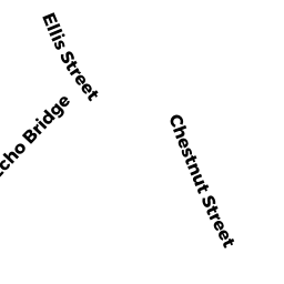
953 CHESTNUT ST
Owner Information
LIN KUNCHING
953 CHESTNUT ST
NEWTON, MA 02464


Property Details
953 CHESTNUT ST is classified as a Single Family Residential (Colonial).
The primary structure on this property was built in 1993. There are 5,006ft2 of built area within this property. There is 2,385ft2 of residential/living space within this property. This property is listed as having 9 rooms.
953 CHESTNUT ST is valued at $1,233,900. The land is valued at $600,600 and the structures are valued at $633,300.
This property is in Zone MR1. Confirm with local Zoning Board authorities to ensure there are no overlays or other easements on this property.
The most recent deed for 953 CHESTNUT ST is recorded at the local registrar in Book 78193, Page 475. 953 CHESTNUT ST was last sold on Wednesday, July 7, 2021 for $1,420,000.
Assessment data from fiscal year 2022.
Flood Data
According to the FEMA National Flood Hazard Layer, this property does not appear to be in a flood zone. It may also be in an area not yet reviewed. Nonetheless, confirm this information prior to taking any action.
To view the flood hazards around this property, create a FEMA "Firmette" Map of the area around 953 CHESTNUT ST.
Broadband Internet Providers
| Provider | Type | Bandwidth (mbps) | |
|---|---|---|---|
| Verizon New England Inc. | DSL | 5 | 0 |
| Crown Castle Fiber | Fiber | 0 | 0 |
| Viasat Inc | Satellite | 100 | 3 |
| Verizon New England Inc. | Fiber | 940 | 880 |
| Comcast | Cable | 1000 | 35 |
| RCN | Cable | 500 | 20 |
| RCN | Cable | 1000 | 20 |
| GCI Communication Corp. | Satellite | 0 | 0 |
| HughesNet | Satellite | 25 | 3 |
| VSAT Systems, LLC. | Satellite | 2 | 1 |
Broadband service provider data from December 2020.
Adjacent Properties
- 965-967 CHESTNUT ST 965
Residential Condominium owned by MARCELIN LILLY E - 965-967 CHESTNUT ST 967
Residential Condominium owned by KUN STEPHEN C - 965-967 CHESTNUT ST
Other, Open Space owned by 965-967 CHESTNUT ST MASTER DEED - 38 ELLIS ST
Single Family Residential owned by WESTSTRATE EVAN R - 14 ELLIS ST
Single Family Residential owned by AGHAJAN YASMIN - 959 CHESTNUT ST
Single Family Residential owned by SINANI MARIO - 947-949 CHESTNUT ST 947-2
Residential Condominium owned by BAI XIAOBO - 947-949 CHESTNUT ST 947-3
Residential Condominium owned by MUIA MARIA C - 947-949 CHESTNUT ST 949-1
Residential Condominium owned by TRUNCER JAMES J - 947-949 CHESTNUT ST
Other, Open Space owned by 947-949 CHESTNUT ST MASTER DEED